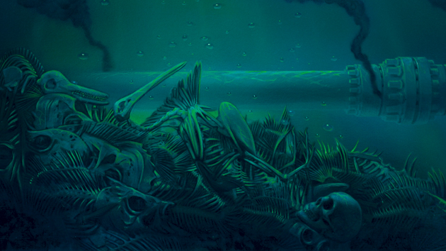
Illustration: Tim O’Brien
Read also: The rest of this special report and MoJo‘s complete BP coverage.
WE’RE SWINGING ON ANCHOR this afternoon as powerful bursts of wind blow down through the Makua Valley and out to sea. The gales stop and start every 15 minutes, as abruptly as if a giant on the far side of the Hawaiian island of Oahu were switching a fan on and off. We sail at the gusts’ mercy, listing hard to starboard, then snapping hard against the anchor chain before recoiling to port. The intermittent tempests make our work harder and colder. We shiver during the microbursts, sweat during the interludes, then shiver again from our own sweat.
I’m accompanying marine ecologist Kelly Benoit-Bird of Oregon State University, physical oceanographer Margaret McManus of the University of Hawaii-Manoa, and two research assistants aboard a 32-foot former sportfishing boat named Alyce C. On the tiny aft deck, where a marlin fisher might ordinarily strap into a fighting chair, Benoit-Bird and McManus are launching packages of instruments: echo sounders tuned to five frequencies; cameras; and a host of tools designed to measure temperature, salinity, current velocity, chlorophyll fluorescence, and zooplankton abundance, all feeding into computers lashed into the tiny forward cabin.
Despite the impressive technology crammed aboard the boat, its deployment is pure 19th century. At any given time, two of us man the aft winch, launching the equipment overboard by hand, feeding out dual lines of nylon and coaxial cable, slowly wearing calluses into our gloves as we ease the instruments through the water column at roughly 33 feet per minute. Six feet shy of the bottom, 74 feet down, the rig is hauled back up, collecting data the whole way. The process is repeated around the clock for the next 24 hours, a procedure either monotonous or meditative, depending on your frame of mind. Near the bottom, McManus calls, “Making a mark.” She might as well be calling “mark twain.”
But whereas old-time riverboat captains sounding with lead-weighted ropes were gleaning information about safe shipping channels and shifting sandbars, we’re sounding for signs of life. To the untrained eye, the incoming echo soundings appear as waves of blue, green, and yellow scrolling horizontally across our computer monitors. To the trained eye, they appear as layers of life flooding in on darkness. Benoit-Bird points toward the screens, each one tuned to read the sonar signature of a different-size life form. “That layer is zooplankton,” she says. “And that layer is fish.” Suddenly, I can see a crude facsimile of the migrations of the nighttime sea.
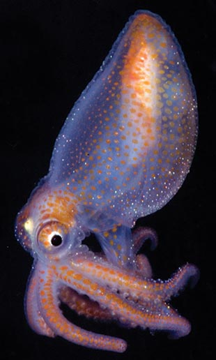 Creatures living in the deep scattering layer of the Gulf of Mexico include juveniles like this octopod.
 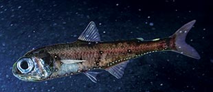 Lantern fish like this one are a keystone species in the marine food web.
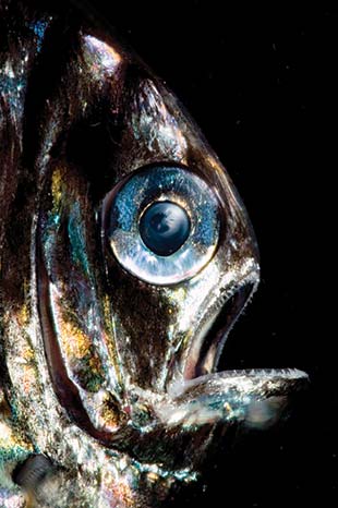 DSL species like hatchetfish have light-emitting organs.
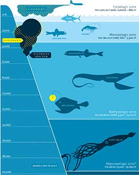
Most of the marine life familiar to us at the surface inhabits the epipelagic zone, the sunlit realm, stretching down to about 600 feet. Yet many whales, dolphins, seals, sea turtles, sharks, manta rays, billfish, and smaller predatory fish are nocturnal hunters, dependent on the mysterious movements of a vast community of organisms known as the deep scattering layer (pdf), or DSL. This aggregation of life forms was unknown until the 1920s, when early hydrographers mapping the ocean with sound encountered a daytime “seafloor” around 3,300 feet, which rose perplexingly toward the surface at night. Named for its echo-reflecting signature, the DSL was eventually recognized by marine biologists in 1948 to be layers of living creatures hiding on the cusp between perpetual twilight and darkness.
What the echo sounders of old were actually picking up were the billions of swim bladders (buoyancy floats) of the fish inhabiting the dark realm of the DSL—primarily lantern fish, bristlemouths, and hatchetfish. These fish, generally between one and twelve inches long, are endowed with the usual fishy hardware of fins, scales, lateral lines, and tails. But their habit of hiding in the darkness by day and chasing darkness upward at night led to the development of extraordinarily large eyes and organs, known as photophores, capable of producing light—usually a weak blue, green, or yellowish light—the color and pattern of which signal the fish’s species and gender, as well as information used in shoaling and other communications we don’t understand. The photophores also create a camouflage known as counterillumination. By adjusting internal dimmer switches, these mesopelagic (“middle sea,” or twilight zone) fish match the slightest overhead ambient light level—be it the faint glow of the sun or moon—making their silhouettes less visible to predators above and below.
DSL species rise at night—some to waters as shallow as 30 feet deep—for a variety of reasons: Some are avoiding the daytime surface hunters; others are avoiding the nocturnal hunters of the DSL who don’t rise (like lancetfish); still others are saving energy by spending their days in a sleeplike state prompted by the frigid waters. (The alternative, living only at the warm surface, produces a fast metabolism requiring more food.) Krill, among the most abundant and important invertebrates of the DSL, rise at night to graze on the pastures of the sea: single-celled phytoplankton, plants that survive only in the sunlight zone.
The lantern fish, bristlemouths, hatchetfish, and crustaceans of the DSL are believed to account for 80 percent of all the biomass in the mesopelagic zone, with lantern fish alone making up some 660 million tons of living fish—perhaps the greatest distribution, population, and species diversity of all ocean fish on the planet. The mesopelagic fauna also includes many kinds of squid, krill, and siphonophores and ctenophores (jellyfish-like animals), as well as worms, sea butterflies, and larvae that comprise the DSL zooplankton. The vast life of the deep scattering layer supports the surface life above it, including the $172 billion global seafood and aquaculture industries (pdf).
It’s no wonder then that most of the predators of the sunlit sea make their living diving to meet the DSL, which rises like a great dumbwaiter from the deep bearing every manner of seafood delicacy on a platter of darkness. No wonder, too, that the DSL is being eyed by the fishing industry as the last great resource to be exploited.
Not long after dark, dolphins show up on the data stream, monopolizing the monitors with bold red and orange signatures. These are spinner dolphins who’ve spent the daytime hours resting in shallow coastal waters, hiding from sharks, sleeping with eyes wide open and their echolocation shut down. During the couple of years in the ’90s I spent filming a documentary about spinners, darkness marked the frustrating end of our workday, the time we were forced to leave the school behind, to listen wistfully to the sounds of their leaps and spins as they splashed on an ocean surface we could no longer see. They were racing offshore to begin diving into the deep scattering layer. This much we knew. But in filmmaking parlance, it was called “dip to black.” Because what the dolphins did down there in the dark was unknown, and seemingly unknowable.
JUST ABOUT THE TIME WE drop anchor off Oahu, and unbeknownst to us, a catastrophe is being unleashed 4,400 miles and five time zones away, in the Gulf of Mexico. A mile below sea level, methane is shooting up the experimental well drilled by the Deepwater Horizon rig, exploding at the well’s head, killing 11 workers, and igniting a firestorm. After 36 hours of a raging inferno—and still unknown to any of us—the rig will sink and open a valve to the gargantuan reservoir of the Macondo oil field, estimated to contain perhaps as much as 1 billion barrels, or 42 billion gallons, of crude.
Though it won’t be understood for weeks, the Deepwater Horizon is different from any other spill in human history. The extreme technology used to drill at unprecedented depths lacks the extreme safety equipment and protocols needed to stave off disaster. BP, gambling at the border of controllable engineering, has lost spectacularly in its bid to be the deepest and cheapest driller of them all.
And no one is ready for it. Not the Minerals Management Service, catering submissively to BP’s laughable Gulf oil-spill “plan,” a document featuring wildly inaccurate wildlife assessments (including walruses and other species nonexistent in the Gulf) and an on-call expert who’s been dead for years. Not the scientists whose research is paid for by the oil cowboys. Not the environmental groups, who did not foresee the stupendous potential for cataclysm on oil’s farthest frontier. Not the media, who almost entirely ignored the sneak preview offered last year by the blowout of the West Atlas rig drilling in the Timor Sea off Australia—a disaster that required five attempts at a relief well and 74 days to stanch. Far offshore, far from sight, far beyond the typical royalty-paying boundaries, BP and its partners have transformed themselves into modern-day pirates, operating beyond law or conscience. Their reckless quest has endangered and perhaps condemned not just the Gulf Coast, but the largest, richest, most pristine, most biologically important, and last completely unprotected ecosystem left on Earth: the deep ocean.
Despite an ever-expanding estimate of the volume of the spill, relatively little oil washes ashore at first, and only a small portion ever will. Instead, trapped in the deep, the oil fouls the ocean’s twilight and dark zones: the mesopelagic and the bathypelagic (bathos: deep). After April 20, the dumbwaiter rising through the waters of the Gulf of Mexico will be ascending an ocean fouled with a toxic broth of oil, methane, chemical dispersants, and drilling mud. The relatively small amounts of oil washing ashore, and the relief felt when the surface oil began to dissipate, hardly account for the devastation being wrought in the dark world beyond our sight.
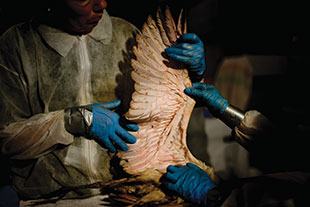 Bird rescue workers examine a dead juvenile roseate spoonbill in Fort Jackson, Louisiana.
SIX WEEKS AFTER THE Deepwater Horizon explosion, I’m aboard a small inflatable Greenpeace boat, bucking the marshy waters of Barataria Bay, Louisiana. A tide change is under way. Incoming and outgoing waters are flowing in opposing directions, battling each other in current lines inked with oil. A continuous flow of vessels chug through the pass—tugboats, barges, mud boats, seiners, trawlers, pirogues, airboats, sportfishers, pleasure cruisers. Some carry crews to and from the thousands of other drilling platforms puncturing the seafloor of the Gulf of Mexico, but the majority are now laden with containment boom and BP cleanup crews.
Dolphins are swimming in the pass too, a few dozen of an estimated 138 to 238 bottlenose dolphins that call Barataria Bay home. They’re hugging the greasy waves of the tidal rip. Like bottlenose dolphins the world over, and like much marine life in general, they’re exploiting the edge where waters of different provenance (temperature, salinity, velocity) hide predators from prey and vice versa. Along these edges, the sensory systems of the sea—sight, sound, pressure wave, magnetic field—are dimmed or distorted, making it difficult to see from one side through to the other. Bottlenose dolphins use the distortions as natural hunting blinds.
These waters have been off-limits to human fishers for weeks. But nobody told the dolphins. They’re actively fishing the tidal rip and following trawlers dragging boom, because these are the same boats that sometimes give them food in the form of bycatch thrown overboard.
As best we know, the dolphins of Barataria Bay comprise a closed population whose members rarely if ever leave the bay. In theory, they could now exit, but in all likelihood they’re trapped here by multiple barriers: by oily waters, by seasonal tradition, by cultural habit, by territorial boundaries, and by the availability of food—including fish and other marine life that may be trying to escape the oil by swimming inshore. At the moment, the dolphins are feeding as best they can in home waters that will likely kill them.
Rick Steiner, a conservation specialist from the University of Alaska who’s studied the effects of the Exxon Valdez spill for the past 21 years, discusses these possibilities as we look on helplessly. “The dolphins aspirate oily fumes through their blowholes,” he says. “They’re eating fish exposed to oil. They’re getting oil in all their orifices. They’re bathed in a continual soup of oil. There’s nowhere to go to get away from it. We know from the Exxon Valdez that even those animals not killed outright suffer lesions in their organs, including the brain. They go blind. They experience reproductive failures, changes in their blood chemistry, and possibly multigenerational changes passed down to offspring never even exposed to the oil.”
A few hundred yards away, tucked into the marsh grass on Grand Isle State Park, we see a dead dolphin, half-skeletonized, half-mummified. In the heat and humidity of coastal Louisiana, it is hard to tell if it’d been dead a week or a month. We do know that dead dolphins are washing up along the Gulf Coast in higher-than-normal numbers. We don’t know how many more have died at sea and sunk, never to be counted. On the beach surrounding the dead dolphin are hundreds of hermit crabs coated with a chocolatey syrup of oil, their tracks up the beach splattered as they fled the foul waters. The oil washing ashore is still actively bubbling. “Even though this concoction may have exploded from the well a month ago and has been wending its way ashore ever since, it’s still full of volatile compounds like benzene,” says Steiner. “Benzene’s a known carcinogen, dangerous to human life, too.”
Barataria Bay has become a hospice wilderness, full of dying plants and animals. Nearly all the marshy islands are oiled. The oyster beds covering 10 percent of the bay (pdf) are dead or dying and now closed to human harvesting. The post-larval brown shrimp (pdf) migrating into the bay (the estuaries of Louisiana and Texas are home to the highest densities of brown shrimp in US waters) are running an oily gauntlet. So are the speckled trout that normally feast on brown shrimp during their own breeding season. For the first time in my bird-watching life, I’ve seen multitudes of clapper rails—notoriously secretive marsh-dwelling birds—running down levees and roads in broad daylight trying to escape the oiled wetlands.
The fate of the marshes is inextricably linked to the fate of the deep ocean—and vice versa. The deep ocean seeds the marshes with the larvae of fish and invertebrates, which then repopulate the deep in their juvenile or adult stages. These inshore-offshore migrators include ecologically and commercially important species. Fifty percent of the wetlands in the lower 48 states line the Gulf of Mexico and produce more seafood than the Chesapeake Bay, South and Mid-Atlantic, and New England fisheries combined. Endangered Atlantic bluefin tuna, scheduled to spawn right now in the waters around the Deepwater Horizon blowout, migrate here because the Gulf’s marshes—the ocean’s womb—likely shelter and feed their larvae. Adult bluefin, deep divers, are hunting the depths to 3,300 feet (pdf) in search of squid and crustaceans in the deep scattering layer. BP’s oil will wallop them at all stages of their lives.
At Queen Bess Island, an important seabird rookery near the mouth of Barataria Bay, Steiner and I watch oily brown pelicans trying to preen themselves clean. I visited this same island a week ago; the downy pelican chicks who were still in the nest then are today slipping on oily rocks at the waterline. Where last week there were still a few dozen white pelicans, now there are only two, standing uncharacteristically alone, wings drooping in stress. Steiner points out the pelicans flying overhead, their bellies coated with oil. “Even those birds who are managing to avoid diving into contaminated water to feed are inadvertently floating on it,” he says.
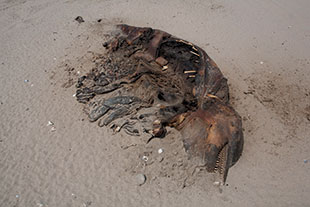 A dolphin carcass in Port Fourchon, Louisiana.
Death by oil is a horrible way to go. Necropsies on birds reveal hypothermia resulting from oiled feathers, malnutrition resulting from the hypothermia, anemia from the shock and stress of hunger, and poisoning from the oil ingested and inhaled during preening. Although a few birds will escape the immediate lethal effects, their eggs and chicks will not. An experiment from the 1980s with nesting Leach’s storm-petrels—tiny seafaring birds breeding on islands off Newfoundland—found that birds exposed to crude oil or Corexit (the dispersant BP is using in the Gulf) lost more eggs and chicks than did control birds. This, even though the oil exposure was sublethal, and even if only one adult of the pair was oiled. Breeding success for adults generally returned to normal the following year—except in the case of birds exposed to the highest sublethal doses of oil or Corexit. Fewer of those birds returned to breed—indicating that their part in the experiment had proved lethal after all.
As bad as it is in Barataria Bay, it’s only the beginning.
FROM THE OUTSET, BP has fought to control every aspect of its uncontrollable catastrophe other than the spill itself. It has wildly spun the numbers on the quantity of hemorrhaging oil. It has continued to dispense Corexit—above and below water—when ordered to stop. It has restricted press access with Kafkaesque flair. Unable or unwilling to skim much oil, BP has poured its energies into skimming up all available resources: renting virtually every hotel room on the Louisiana shores, helping to keep the press at bay; buying the silence of scientists with lucrative pay and confidentiality clauses; chartering nearly every boat on the coast and employing virtually every fisherman and captain made jobless by the spill. I find clusters of these men in the marshes and out in the Gulf, their boats tethered together so they can watch movies on the biggest boat’s DVD player.
“They have to pay these guys to work or else they’ll riot,” says Carl Safina, marine conservationist and cofounder of the Blue Ocean Institute. “As it is, they’re angry, drinking, griping in the bars. By paying them, BP is deflecting their anger. Plus some of them feel like they’re really helping, even though BP’s two prime cleanup methods—setting out boom and using dispersant—completely undermine each other.”
The containment and absorbent boom that BP is deploying around beaches and marshes—largely ineffectively—is designed to do just that: contain and absorb oil. But the Corexit dispersant BP has flooded onto the leaking wellhead 5,000 feet down, and sprayed from the air onto the surface—some 2 million gallons in total—is designed to break up the oil. “Which one is it?” asks Safina. “Do you want to contain it or disperse it? It makes absolutely no sense to be doing both. Let’s face it, with pollution, you count your lucky stars if you have what’s called point-source pollution, that is, a single identifiable localized source of pollution, like the Deepwater Horizon. So what’s BP doing with that? They’re turning it into the worst pollution nightmare of them all: non-point-source pollution.”
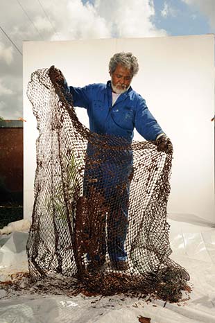 Cajun oysterman Flip Tayamen shows his nets clotted with the crude oil washing into Barataria Bay.
That’s because untreated oil quickly rises to the surface, where it can be skimmed with relative ease. But treated with dispersant, it becomes a submerged plume, unlikely to ever float to the surface, and destined to migrate through underwater currents to the entire Gulf basin and eventually the North Atlantic. “Oil is toxic to most life,” says Steiner. “And Corexit is toxic to most life. But the most toxic of all is oil that’s been treated with Corexit. Plus, dispersants may well kill the ocean’s first line of defense against oil: the natural microbes that break oil down for other microbes to eat.” The EPA has never seriously examined Corexit’s effects on marine life (see “Bad Breakup“). Now it’ll get the biggest and baddest field experiment of all time, as the flora and fauna of the shallows and the deep scattering layer collide with the dispersed plumes.
BP’s schizophrenic approach to the cleanup becomes more insidious in light of the company’s legal liabilities: The Clean Water Act stipulates that BP must pay $1,100 for every barrel of oil proven to have been spilled—$4,300 per barrel if gross negligence is determined. But the use of dispersants clouds estimates of the spill’s size, guaranteeing that the true number will never be known—since relatively little oil will ever wash ashore—and guaranteeing that BP’s liability will be vastly underestimated.
Consider that while we’ve all been fixated on the true spill rate—is it 35,000 barrels a day? 60,000 barrels? More?—those figures are only estimates, and only of the oil. Few people realize that some 40 percent of what spews from the Deepwater Horizon well is methane, the primary component of natural gas—a dangerous greenhouse gas and a toxin to most life. Indeed, methane may hold the answer to the quantity of vented oil. David Valentine, a biogeochemist at the University of California-Santa Barbara, suggested in May in an op-ed (pdf) in the journal Nature that plumes of dissolved methane could be used to calculate how much oil has leaked into the Gulf of Mexico. But BP has blurred the evidence trail—intentionally or otherwise—by treating at least some of the escaping methane with methanol, another toxin, in an effort to prevent a dangerous buildup and possibly even another explosion. Nevertheless, around the spill site, Valentine and his colleagues found clouds of dissolved natural gas at 100,000 times the normal density and at depths of more than 2,500 feet. They also found that little of the gas seemed to be reaching the air. Which is good news for the atmosphere, but probably bad news for the ocean. That’s because the methane may also be powering up blooms of microbes that eat methane but use up the oxygen in the water as they do so—causing dead zones where most life cannot survive. The Gulf of Mexico is already home to the second-largest dead zone on Earth; the last thing it needs is another. On the surface above the methane clouds, Valentine and colleagues discovered a mass kill of pyrosomes—free-floating colonies of jellyfish look-alikes that straddle the vertebrate-invertebrate divide, and an important food for sea turtles. It’s not yet clear which of many smoking guns killed the pyrosomes. “We’ll be working up the story of the relationship between dispersant, oil, gas, and the microbial community for some time to come,” says Valentine.
Then there are the drilling fluids contaminating the seafloor near the wellhead. Euphemistically called muds, these heavy fluids are pumped into wells to keep the highly pressurized oil and gas from exploding upward. BP’s drilling muds have been pouring out of the wellhead, along with 30,000 barrels added in its failed “top kill” and other efforts to plug the leak. Along with oil, methane, methanol, and Corexit, drilling fluids add their own frightening recipe to the disaster: arsenic, lead, mercury, cadmium, barite, fluoride, chrome lignosulfonate, vanadium, copper, aluminum, chromium, zinc, radionuclides, and other heavy metals. Relief wells require pumping thousands more barrels of drilling fluid into the reservoir, with all the same risks of explosion attending the original well. The EPA estimates these drilling fluids will pose a threat to the seafloor and surrounding waters for up to 40 years. Plus a recent study finds that oil spills create a whole new pathway for arsenic (pdf) pollution in the sea. The oil prevents seafloor sediments from bonding with and burying arsenic that naturally occurs in the ocean. This shutdown of the natural filtration system allows arsenic levels to rise from the deep water to the surface, disrupting photosynthesis in phytoplankton, increasing birth defects and triggering behavioral changes in marine life, and killing animals that feed on poisoned prey.
Never before in human history has the vast food web of the ocean—rooted in the dark, and flowering at the surface—come under so many assaults from below, above, and within the water column: marine warfare masquerading as a cleanup.
“WE DOVE DOWN in clear water but came up 30 minutes later through oil,” says Nancy Rabalais, director of the Louisiana Universities Marine Consortium (LUMCON), a research station tucked deep in the marshes of southern Louisiana in the village of Cocodrie. A few weeks after the spill, during her summer research surveys 10 miles offshore, Rabalais personally encountered BP’s plumes, which will probably affect her research far into the future. “It was horrible,” she says, grimacing. “We were covered. Our gear was covered. We were breathing fumes and tasting oil.”
The last time I saw Rabalais, after Hurricane Katrina in 2005, LUMCON was trashed: the station evacuated, the marshes littered with drowned trees, broken boats, unroofed houses. The area is ruined in a whole new way today. Along with the oil, dispersant, benzene, and everything else creeping into the bayous, Cocodrie has become a staging point for BP—complete with Louisiana National Guard troops, workers recruited from all over the South, and fishermen hired away from their extinct jobs. These men are cashing in their lunch chits at the Coco Marina restaurant, where Rabalais, Ed Chesney—LUMCON’s fisheries biologist—and I are grabbing a meal. We watch every manner of boat known to Louisiana speed up the narrow channels to the marina, their white hulls stained BP brown, their wakes slapping the cordgrass flat. The boats offload hundreds of hungry men.
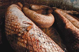 Containment boom and fiddler crab covered with oil, Barataria Bay, Louisiana.
Rabalais is worried about the species already under enormous stress from a host of other environmental problems in the Gulf: dead zones, overfishing, chronic oil pollution, seismic testing for oil and natural gas, coastal erosion (see “Fate of the Ocean,” March/April 2006 issue). “Brown pelicans just came off the endangered species list,” she says, “and now some of their most important breeding rookeries are getting hit with oil.” She’s concerned about critically endangered Kemp’s Ridley sea turtles, the rarest on Earth, a species that faced mortal threat from the 140 million-gallon spill (pdf) at the Ixtoc I drilling platform in the Gulf in 1979 (see a map of the world’s biggest spills here 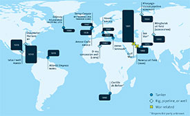
Click on the image to expand to full size.). Kemp’s Ridleys breed almost exclusively in the Gulf, with virtually every female returning to lay her eggs on a stretch of beach south of the Texas border.
In the wake of the BP spill, there’s been a spike in sea turtle deaths, the majority of them Kemp’s Ridleys. The number is certain to rise, since some sea turtles feed in the DSL, and most enjoy a meal of jellyfish. Sadly, they also eat blobs of oil they mistake for jellyfish. According to some reports, sea turtles have been roasted alive in the surface-oil patches burning offshore. Hundreds more have drowned since the disaster began. One shrimp fisherman privately admits that panicky colleagues fished hard in the weeks after the spill, knowing that the fishery would soon be closed, and some tied shut the mandatory turtle-excluder devices, which save turtles from drowning but reduce the efficiency of their nets.
Rabalais and others also worry about the Gulf’s sperm whales, which feed on squid living in the deep scattering layer. An estimated 1,665 sperm whales inhabit (and perhaps never leave) the northern waters of the Gulf. A recent National Oceanic and Atmospheric Administration (NOAA) assessment calculated that even three additional deaths (by other than natural causes) could endanger the entire sperm whale population, since the whales breed infrequently and only in midlife. The whales favor the deep waters of Mississippi Canyon—the location of the Deepwater Horizon wellhead. On numerous occasions, they’ve been seen swimming through thick oil in that region. And it’s not only sperm whales. The Gulf is home to 29 species of cetaceans, many of which feed on the DSL, including spinner dolphins, spotted dolphins, pilot whales, killer whales, and many secretive deep divers such as beaked and bottlenose whales. The filter-feeding whales—including the Gulf’s tiny isolated population of Bryde’s whales, plus humpbacks, fins, minkes, and sei, many of which are DSL feeders—are vulnerable a whole different way, since oil fouls their baleen (sievelike teeth), dooming them to starvation.
And then there are the 400 Florida manatees, a species classified as vulnerable to extinction, that migrate to Louisiana (pdf) waters each summer. This year they’ll be feeding in oily water on oiled algae and cordgrass. “And it’s not just the large fauna we worry about,” says Rabalais. “The entire wetland is at risk. A marsh that’s been heavily oiled becomes anaerobic at the roots. The next time a big storm comes through, those marshy islands will in all likelihood just break up and disappear.” If so, they’ll take the nursery grounds for marine life with them. Coastal Louisiana is already losing 24 square miles of wetlands a year, a football field every 30 minutes. These dwindling wetlands are crucial to the Louisiana economy, keeping people here afloat in businesses from fishing to tourism. “Now they’re all out of work,” says Rabalais. “And the revenues we were counting on to rebuild the coastal habitats to foster the birds, shrimp, fish, dolphins, turtles, whales, and people will be lost.”
Least certain of all is what’s happening to the life at the bottom of the Gulf of Mexico. Take the life that congregates around cold methane seeps, the first of which ever discovered was found in the Gulf in 1984. Since then, 50 more sites have been located in these waters, some close to the Deepwater Horizon, with hundreds more likely out there—all home to otherworldly collections of crustaceans, snails, bacterial filaments, and tubeworms. The rules of life are different in the gassy depths, where life capitalizes on the same fossil fuels we’re drilling for. Some cold-seep tubeworms have lifespans of 250 years. Others recently found in the deepest seeps may live to 500 or 600 years.
Though some of these creatures feed on methane, that doesn’t mean they can survive the spill. “The quantity of oil and the added effects of dispersants are likely to harm these communities,” says Lisa Levin, a biological oceanographer and cold-seeps specialist from the Scripps Institution of Oceanography. Oil could smother the animals’ feeding apparatus or suffocate the bacteria at the base of the food chain, she adds. “The tubeworms and other seep organisms, including perhaps deepwater corals, are so slow-growing that damage will likely be long lasting.” Levin envisions a host of long-term chronic problems throughout the deep Gulf that might not even show up for decades.
Only 25 miles from the Deepwater Horizon blowout, a tremendously rich area known as the Pinnacles hosts deepwater corals 300 to 500 feet below the surface. One of the Gulf’s invisible splendors, these ancient reefs line the outer continental shelf south of Mississippi and Alabama. During the last ice age, when today’s continental shelves were dry land, the Pinnacles were living coral reefs near the shoreline. Nowadays the fossil reefs lie too deep and dark for most reef-building corals or phytoplankton to survive. Instead, they’re largely fueled by zooplankton, which power rich deepwater communities of soft corals, sponges, feather stars, black corals, solitary hard corals, and predatory fish, including reef fish not found in shallow waters. The site is also a critical spawning habitat for commercially important species like grouper and snapper.
“We lack even a good picture of life in the deep Gulf,” says Ed Chesney. “Now we may never know what’s been done to it.” It’s the classic iceberg equation: a nine-tenths submerged hazard, lurking unseen in the darkness. The big question: Will it wreck the Gulf of Mexico? “The best thing that might happen now,” says Chesney, a battle-scarred veteran of Hurricanes Katrina, Rita, Gustav, and Ike, “is for one, two, three, or four hurricanes to blow through and bury all this pollution under layers of sediment.”
His thinking is that the tons of silt accompanying storm surges would inter the contamination and prevent it from migrating further, while more silt stirred up offshore would provide particles for the emulsified oil droplets to adhere to and sink to the bottom. Huge offshore waves could also trigger subsurface landslides to bury some of the polluted seafloor under clean sediment: nature’s dip to black.
Yet the potential benefits of hurricanes are accompanied by obvious risks. Hurricanes will drive pollution further inland. The 33,000 miles of pipeline in the Gulf’s waters and marshes are critically vulnerable to hurricane-induced waves (see chart 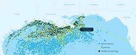
Click on the image to expand to full size.). Seven weeks after the Deepwater Horizon spill, naval scientists released the results (pdf) of research conducted when Hurricane Ivan swept through the Gulf in 2004. It found these pipelines to be far more vulnerable than previously thought to deep storm currents, which slosh for up to a week with enough force to break pipelines 300 feet deep. Plus every hurricane in this storm-prone region threatens the cement seals on 50,000 holes punched into the floor of the Gulf: some wells in deep water, many in the shallows, 27,000 of them abandoned and unmonitored, 600 once run by BP. The passage of Katrina spilled 8 million gallons of oil from platforms, pipelines, ships, and storage tanks—three-quarters as much oil as was dumped by the Exxon Valdez.
All of which adds up to the realization that our collective “don’t ask don’t tell” attitude toward the deep ocean—mining it, drilling it, overfishing it, dumping in it (including nuclear waste), polluting it, and deafening and killing its life with lethal sounds produced by the drilling industry and the military—is a prescription for ruin. “It’s not that we were totally unprepared for the possibility of the Deepwater Horizon,” says Carl Safina, “but that we were so spectacularly unprepared for its inevitability.”
IRONICALLY, THE TOOLS Kelly Benoit-Bird and Margaret McManus are employing in Hawaii to decipher the deep scattering layer were developed by the offshore oil and gas industry and the military. “The DSL was a hot topic during the Cold War,” says Benoit-Bird, “but only its acoustic properties, not its biological properties. American and Soviet navies wanted to know how to use its sound-reflecting properties to hide their submarines.” In the 21st century, the application has shifted to the oil industry’s fight to drill deeper, a battle spurring technological innovation in echo sounding and imaging equipment—including the “spill-cam,” whose footage BP was finally pressured into releasing. “As offshore rigs proliferate and get deeper,” says Benoit-Bird, “the once-prohibitively expensive gear attending them became cheaper and more accessible, to the point where the smallest players, the research scientists like Margaret and me, can now afford some of it.”
The data streaming in from the waters off Oahu—the yellow, green, red, and blue bands scrolling across the computer monitors—are unprocessed data, designed to signal that the submerged gear is working correctly. Back in Benoit-Bird’s office at Oregon State University, I watch the information transform into geek IMAX. The animations show spinner dolphins gathering in a circle of 16 to 28 animals, always an even number, each dolphin paired with another, the pairs arranged in an echelon formation: one animal slightly above and ahead of the next, while maintaining about three feet of separation. A perimeter of roughly 300 feet is precisely maintained as the dolphins swim in an undulating circle, trapping the fish inside the net of their swimming bodies.
One after another, in fixed sequence, two dolphin pairs directly opposite each other dart into the ball of fish to feed. As they return to the circle, four more follow. And so on. The action is extremely fast, the dolphins darting in to feed at a rate of roughly 1.25 prey per minute, all while swimming and circling in their roller-coaster pattern. After five minutes below, each pair has engaged in four feeding dashes, and the dolphins simultaneously surface to breathe. They typically grab only one or two quick breaths before diving, repeating the underwater rodeo over and over throughout the night without rest. “Our research indicates that spinner dolphins are forced to fish hard and continually all night,” says Benoit-Bird, “and to catch the biggest of these tiny four-inch-long fish they possibly can in order to meet their metabolic requirements.”
In other words, they exploit a different kind of edge—the fine line between survival and starvation. This precarious balance tips back and forth across the food web of the deep scattering layer. “In order to really understand what the dolphins are doing,” says Benoit-Bird, “we had to understand what their prey are doing. And in order to do that, we had to decipher what’s behind the movements of the deep scattering layer. This investigation led us incrementally backward over time towards the smaller and smaller organisms—which, as it turns out, drive the entire system.”
Margaret McManus was part of the team that first discovered a remarkable phenomenon rewriting our understanding of ocean dynamics—the formation of thin plankton layers in the ocean. These congregations of plankton, both the plant and animal varieties, may extend for many miles horizontally but inhabit a few feet on the vertical scale—sheets of life packed far, far more densely with life than the water just above or below them. The formation of thin layers is driven by the chemistry and physics of the ocean, as well as by the organisms themselves. Off Hawaii, they tend to form where cooler waters well up from the deep during tide changes.
McManus and Benoit-Bird have found that DSL fish will swim hard against prevailing currents in order to get to these dense aggregations of life. It’s an energy-consuming choice offset by the rich feeding rewards. In Benoit-Bird’s data animations, single fish dive into a thin zooplankton layer and swim up and down, back and forth, eating a doughnut hole in the layer. The spinner dolphins do something similar: diving to find patches of lantern fish that they then corral increasing the prey density by up to 200 times. “It’s so congested in there for these nonschooling fish of the DSL,” says Benoit-Bird, “that they’re probably bumping into each other in confusion.”
The emerging picture is one of an incalculably complex, finely tuned, and delicate interaction between predators and prey, chemistry and light, currents and water column, night and day. Some semblance of this spatial ballet, played in weightless three-dimensional darkness, has likely been part of the oceans since the oceans were brought to life: layers of life gathering in extremely high densities to feed or to avoid being eaten.
So what happens if you add millions of gallons of oil, dispersant, methane, and drilling fluid into the dense mix?
“We know that the deep scattering layer in the Gulf of Mexico—like the DSL everywhere—supports huge numbers and biomass of life,” says Benoit-Bird, who has spent time studying the Gulf’s sperm whales. “We know the DSL is super important to the life of those waters. We know it’s constantly on the move, not only up and down, but inshore and offshore, back and forth, every day and every night. This greatly increases the likelihood that any given animal or layers of life will be exposed to the pollutants at some point in the course of their travels. And each of these exposures will cascade up and down through the food web.”
Some early observations of the effects of the Gulf catastrophe suggest the daily vertical migrations of the animals of the deep scattering layer may be blocked when they encounter plumes of oil and contaminants. If so, then trapped below a plume, the DSL fish and invertebrates would be unable to access their prey. Trapped above, they would be unable to escape their predators. Trapped within, they would probably die—and in their deaths, poison those who eat them. For the ocean, any loss of productivity in the deep scattering layer would be the biggest cataclysm of all—impoverishing the surface waters, depleting the coasts, cascading across the boundaries between ocean and land to denude both natural and human economies.
BEFORE BEING WAYLAID by the oil tragedy, I was investigating the emergence of a better future for the ocean—one in which we could use our scientific and technological genius to create a new, exciting, and profitable relationship with our water world, a relationship based on respect and sustainability. I spent a few weeks in Hawaii, where the larvae of many promising ideas are circulating on scholarly and entrepreneurial currents.
At the University of Hawaii-Manoa, I met Luis Vega, who drifted years ago from his natal shores of Peru and landed in American academia. His shock of white hair and his melancholic, ironic air give him the guise of a poet. He told me that when he was working on clean energy in the Jimmy Carter years, he was a popular man. Then he weathered decades of solitude. “Now I’m popular again,” he smiles self-deprecatingly.
Vega is one of the foremost modern developers of OTEC (ocean thermal energy conversion) technology. He managed the design, construction, and operation of an experimental OTEC plant for the production of electricity at the National Energy Laboratory of Hawaii Authority (NELHA) On the Big Island from 1993 to 1998. Today Vega has a new grant, via the Department of Energy and Lockheed Martin, to essentially see if the technology is suitable for commercial investment. “Today, while we talk about wind, solar, and wave power,” says Vega, “we’re ignoring this energy inherent in the ocean, a source far more powerful, far more consistent, than any of those. The beauty of OTEC lies in its unshakable ability to provide energy 24/7, without any of the vagaries of wind, solar, or wave.”
OTEC runs on the temperature differential between the ocean’s deep dark waters and its warmer sunlit zone—the same differentials the creatures of the DSL exploit. In a closed OTEC system, warm surface waters are pumped through a heat exchanger to vaporize a low-boiling-point fluid, like ammonia. Cold deep seawater is simultaneously pumped through a second heat exchanger, creating a gradient that drives the vapor through a turbine to generate electricity. Finally, the cold seawater condenses the ammonia back into a liquid, to be recycled through the system. Both Japan and India are also experimenting with OTEC power plants.
OTEC isn’t the deep water’s only use. At NELHA, the two cold-seawater pipes built for the last OTEC experimental plant today deliver water from between 2,000 and 3,000 feet deep to dozens of surrounding businesses. The 43-degree, extremely clean water enables aquaculture farms to grow cold-water seafood like Japanese abalone, flounder, oysters, and Atlantic lobster in the tropics. The deep water is also being used to raise aquarium fish and helps grow spirulina at one of the largest algae farms on Earth. The hope is that these methods could one day offer a sustainable alternative to wild-caught fish, especially disappearing species, like tuna.
But generating scalable commercial power would clearly be the killer app. The way Vega envisions our energy future, the first generation of OTEC “plant-ships” would be stationed offshore and send electricity via subsurface power cables to shore stations. Then, in 20 or 30 years, the technology would develop to the point where “grazing” OTEC plants could decouple from the land and roam tropical waters in search of the best temperature differentials. These second-generation plant-ships would exploit those differentials, using the energy to break down seawater and create energy-rich compounds like hydrogen or ammonia. Either could essentially serve as a battery—holding energy as it’s transferred to land. And in the case of hydrogen, there might be a robust infrastructure in place to distribute liquid hydrogen (such an infrastructure is being built in California) to be used in fuel-cell vehicles.
Figuring out how or whether OTEC or any of these other alternate energy technologies can provide us with a livable future will take serious investment. Yet until now we’ve barely acknowledged the true costs of subsidizing “cheap” oil: not only the $4 billion a year in actual subsidies, but climate change, the risks to human health, environmental degradation, and disaster. In the wake of the Gulf of Mexico tragedy, alternative energy sources—OTEC, wave, tide, wind, or solar—no longer seem utopian, merely sane.
On the Big Island of Hawaii, the NELHA deepwater pipes run up near a beach park on the shoreline. In the early morning, I see a school of spinner dolphins in the blue water just beyond the breakers. Their night’s intensive work finished, they’re leaping and spinning their way back to shore. During my years filming spinner dolphins, I sometimes joined them underwater during their morning return to land. The sight was a marvel of speed and grace, dozens of slender bodies streaming below the surface at velocities that transformed the school into a waving, blurry contrail of gray and white and black. For me, stationary in the water while the spinners streamed past, as the sun ignited the twilight water, it felt like being inside the eye of a hurricane of intensive, productive, pure energy.
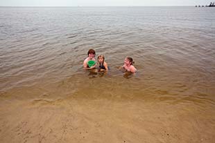 Swimming amid blobs of oil in Biloxi, Mississippi, late June 2010.
On the shores of the Gulf of Mexico, as black doom wells up from the seafloor a mile down, I find oil on beaches repeatedly cleaned by hazmat crews. All I have to do is lean down and scratch an inch into the sand to find goop. It occurs to me that a new stratum is being written in the geological logbook of the Gulf of Mexico, perhaps someday to be known as the BP dark layer. Will history record it as the oily seam marking the end of an untenable energy era and the beginning of a better one?
A dip to black isn’t always the end of the story. Sometimes it’s followed by a fade up from black and a whole new scene.
If you liked this story by Julia Whitty, don’t miss her features on mass extinction, the fate of the ocean, and the planet’s 13th tipping point.
