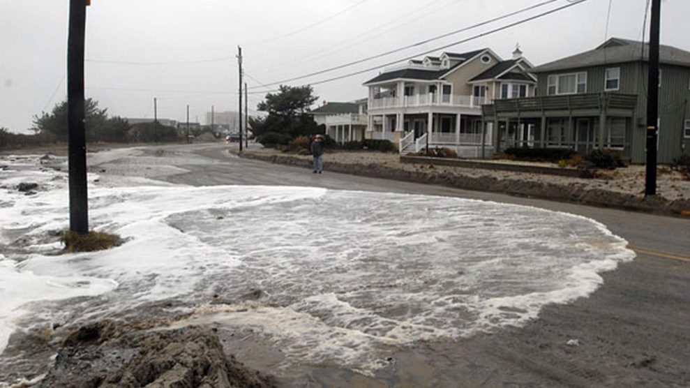
Water from the Atlantic Ocean washes over East Atlantic Avenue in Ocean City, N.J. February 28, 2019.Ron Tarver/Philly.Com/ZUMA
This story was originally published by Wired and is reproduced here as part of the Climate Desk collaboration.
An actual space laser is cruising 300 miles above your head right now. Launched in 2018, NASA’s ICESat-2 satellite packs a lidar instrument, the same kind of technology that allows self-driving cars to see in three dimensions by spraying lasers around themselves as they roll down the street and analyzing the light that bounces back. But instead of mapping a road, ICESat-2 measures the elevation of Earth’s surface with extreme accuracy.
Although this space laser means you no harm, it does portend catastrophe. Today in the journal Nature Communications, scientists describe how they used ICESat-2’s new lidar data to map the planet’s land that’s less than 2 meters above sea level, which makes it vulnerable to the creep of sea level rise. Marrying this data with population figures, they calculated that 267 million people currently live in these at-risk areas. Assuming a sea level rise of 1 meter by the year 2100, they project that 410 million people will ultimately live in an affected zone. Asian countries like Bangladesh and Indonesia are particularly vulnerable, but the United States and Europe will also have no shortage of at-risk populations.
“We strongly believe that if the world is going to be able to deal with sea level rise and to conserve nature in coastal zones—that’s an important aspect—elevation must be known,” says study lead author Aljosja Hooijer, a flood risk expert at the National University of Singapore and Deltares, a research institute in the Netherlands.
The paper’s estimates, Hooijer stresses, are conservative on many levels. For one thing, they did it without factoring in explosive population growth in the world’s cities, because of the uncertainties involved in calculating where people will ultimately move. Currently, 55 percent of the planet’s population lives in urban areas, which the United Nations projects will rise to 68 percent by 2050. But this won’t play out evenly—the populations of certain cities may rise faster than others, or even decline.
“The work fills a very big gap that we have at the moment,” says Arizona State University geophysicist Manoochehr Shirzaei, who studies sea level rise but wasn’t involved in this new research. Scientists have good models of sea level rise, Shirzaei adds, “but when you want to quantify the flood risk, you need to know the elevation as well. And that’s a big unknown.”
But not all metropolises have come to terms with the subsidence crisis. “Some governments have not admitted to it—that it’s a problem,” says Hooijer. “If you want to make policymakers buy this, you have to be a bit on the conservative side. So we decided to go for a uniform subsidence rate.”
A “huge challenge” is to make sure short-term interventions after disasters like hurricanes Katrina and Sandy, “fit into a long-term planning strategy.”
This new modeling is also conservative in that it considers sea level rise but not storm surges, which is the sudden rise in water level during a hurricane or tropical storm. Ever more powerful cyclones will push ever more water ashore. While these temporary surges aren’t the same kind of severe, long-term threat as sea level rise that can overtake a metropolis, “a major storm surge can happen tomorrow, having devastating impacts on communities, but also triggering interventions by the government,” writes climate scientist Jeroen Aerts of Vrije Universiteit Amsterdam in an email to WIRED. “A huge challenge is to make sure these ‘short-term interventions’ after major disasters—Hurricanes Katrina, Sandy, Harvey, etc.—fit into a long-term planning strategy anticipating sea level rise. Unfortunately, this longer-term perspective is often missing.” (Aerts studies sea level rise but wasn’t involved in this new work.)
This new data is meant to provide that perspective. But a shortcoming, says Shirzaei of Arizona State University, is that with a resolution of 5 kilometers (about 3 miles), the data collected from orbit is quite coarse compared to what you’d get from lidar taken from a plane or drone. “Those lidar data have a resolution of 5 or 10 centimeters,” Shirzaei says. “The quality is just amazing.”
But the two sources of data could actually work in concert, says Shirzaei. You could use the satellite lidar to identify particularly vulnerable areas—according to this study, places like Bangladesh and Indonesia—then deploy a plane to map the coast in finer detail.
This kind of data could show which coastal areas could be safely fortified against rising tides, and which are now too dangerous for habitation. Texas, for instance, is considering building a $26 billion barrier to hold back the sea near Houston. In other places, it might make more sense to elevate structures to adapt to sea level rise, Shirzaei adds.
But sometimes an engineering solution just won’t be possible. “Some of the adaptation strategies could be that we just relocate the entire community, because for some reason we cannot defend them using in-place structures like sea walls,” says Shirzaei. This is known as managed retreat, and it’s already happening in some cities. San Francisco, for instance, is giving up part of a coastal highway by replacing two lanes with a trail so the land can better hold back rising waters.
Now, NASA’s orbiting space laser might help policymakers make informed decisions about whether it’s safer to stay or go.


