Image <a href="http://news.sciencemag.org/sciencenow/2010/09/a-new-tool-for-tracking-oil-spil.html">courtesy Science/AAS</a>.
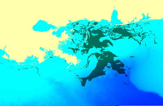
The journal Science has a has a report today on a new tool scientists have developed to predict where and when oil will wash ashore following a spill like BP’s. Using fluid dynamic models, satellite images of the Gulf spill, and data on ocean currents, they were able to create new “visualization software” that can be used to track spills.
From the Science story on the new technology:
Their model gave several days of warning to authorities about where the gulf’s currents would carry the huge swaths of BP oil, and the researchers say the model can predict how any hazardous or unwanted material will spread.
When fluid dynamicist Igor Mezi? of the University of California, Santa Barbara, watched TV reports in late April showing 10,000 or more barrels of crude oil a day spilling into the gulf, he quickly assembled a research team. Mezi?, who has been studying the mixing dynamics of fluids, such as oil and water, for 20 years, says he thought he could develop a better method of predicting where the oil would spread, thereby giving workers more time to deploy containment and cleanup equipment.
Well, at least one good thing may have come from the Deepwater Horizon disaster. Considering there was yet another explosion at a drilling operation in the Gulf yesterday, perhaps this will come in handy.


