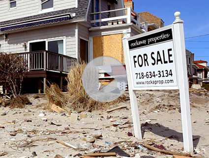
One year ago, when the largest Atlantic hurricane in recorded history swept up the East Coast and collided with a nor’easter, the two massive weather events morphed into a superstorm. Sandy made landfall in New York harbor during a full moon—when the tides are highest—and caused a massive storm swell that flooded much of the region. It was dubbed a Frankenstorm, a Snor’eastercane, the Katrina of New Jersey.
By the time Sandy ran its course, it had created a disaster scenario better than anything Hollywood could dream up. But Sandy wasn’t fiction—and climate models show that within the next hundred years Sandy-sized storm surges* could even become the new norm.
For a recent issue of Mother Jones, we set out to determine how soon we can expect floods like those caused by Sandy and 2003’s Hurricane Isabel—which devastated coastal Virginia—to become regular events. Using data provided by Climate Central and the National Climate Assessment, we found that the chance of another 9 foot storm surge in lower Manhattan reaches 50 percent in a given year by the end of the century. In some low-lying regions of Gloucester County, Virginia, residents can expect four foot storm surges to become a yearly event by 2060.

We also looked at the toll that weather-related natural disasters have taken on the troubled National Flood Insurance Program. Though it has recently undergone reform—raising the rates for many property owners whose homes have been deemed the most vulnerable to flooding (but also dampening the real estate market)—the federal program remains deep in the hole that Katrina created and Sandy deepened.

NOAA, FEMA, Congressional Research Service, White House Federal Budget
To find out how soon you can expect regular major flooding events in your area, type in your city, state, or zip code into Climate Central’s Surging Seas database below and move the water level line.
Correction: An earlier version said Sandy-sized storms could become regular events, but it is Sandy-level storm surges.


