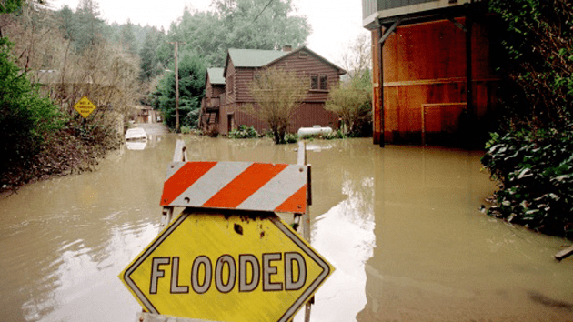
El Niño storms caused California's Russian River to flood in 1998. Scientists predict that this year's rains will rival those of the 1997-98 season.FEMA
After four years of drought, Californians are bracing for another potentially destructive weather event: El Niño. Earlier this week, the Federal Emergency Management Agency, or FEMA, released a disaster plan including what to expect from the upcoming rainy season. Here are the key takeaways:
- This may be the strongest El Niño on record. Weather reports indicate that this year will be warm and wet—perhaps even more so than the winter of 1997-1998, which is currently the strongest recorded El Niño. That year, California evacuated 100,000 people.
- The dry conditions mean more flooding. The lack of soil moisture has made the soil “harden and act like cement,” making it, paradoxically, less likely to soak up the rain. The chance of flooding is far higher than usual, especially in the productive farm country of the Central Valley and the surrounding area—including the state’s capital. “The primary risk areas are in populated areas mostly notably in Sacramento,” the report reads—and because of that, “a major flood situation would have significant impact on the economic, cultural, and political life of California.” Additionally, a catastrophic levee failure in the Sacramento-San Joaquin Delta would jeopardize a major source of water for 60 percent of California homes and for a portion of the state’s agricultural industry.” One in five Californians lives in a flood zone.
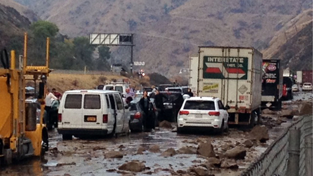
- Wildfires in the summer mean more landslides in the winter. The wildfire season this year was devastating in California, scorching more than 300,000 acres. Mudslides are common in these scorched areas, called “burn scars,” because water quickly runs off and there aren’t trees to keep the soil, rocks, and other debris in place. Southern Californians got a little taste of what this might look like when rain led to severe landslides in October.
- King Tides, El Niño, and the Blob mean higher sea levels and more potential damage. Sea levels typically rise a few inches during El Niño, but this winter, scientists predict that the giant swath of warm water off the West Coast—dubbed the Blob—will lead to a rise of between 8 and 11 inches. State officials are particularly concerned about the potential damage caused by storms toward the end of both December and January, when the highest tides of the winter, called King Tides, are expected.
- The rains may ease the drought but won’t solve it. All this water will certainly ease the drought and raise levels in the state’s depleted reservoirs. But because the state is so behind on precipitation, it’s very unlikely that it will make up for the state’s now four-year water deficit.


